
Tide and current predictions are really important for anyone spending time near or on the water. Learning how to read predictions for tides and currents can help with fishing, boating, sailing, or even just planniang a safe day at the beach.
I want to share everything I know about understanding tide patterns, using the best tide prediction apps, and figuring out how to make the most of these tools, whether for fishing or sailing. This overview helps you understand how tide and current predictions work, why they matter, and how to use them confidently in 2025 and beyond.
Why Tide and Current Predictions Matter
Understanding tide patterns is something I’ve found really helpful for any water activity. Tides are the regular rise and fall of the ocean’s surface caused mostly by the gravity of the moon and sun. Currents are the continuous movement of water, often shaped by tides but also driven by wind and differences in water temperature and salinity.
For anyone who enjoys boating, fishing, or surfing, knowing the best time to go depends on these patterns. Getting caught in a fast moving current or stuck on a sandbar that has just become exposed by a falling tide can quickly ruin your plans or even become dangerous. With accurate tide and current predictions, I always feel more prepared. Whether I’m planning a day of sailing or deciding when to cast a fishing line, knowing what the water is up to gives me an edge.
Tide predictions are not just for recreational use. Many shipping operations, coastal construction crews, lifeguards, and scientists depend on accurate forecasts to do their jobs safely. This is why reliable and timely predictions help so many people, from beginners to professionals.
Understanding Tide Patterns
Tide patterns describe how and when high and low tides happen in a specific area. While tides are regular, they aren’t exactly the same everywhere. I’ve noticed that even beaches just a few miles apart can have slightly different high and low tide times.
Most places see two high tides and two low tides each day. This is known as a semidiurnal tide pattern, and it’s the most common. Some places, though, get only one high and one low tide per day (called diurnal tides), or a mix between the two. Big coastal bays or inlets can have even more complex patterns, which sometimes take a bit of time to understand fully.
The main thing to know is that tides are caused by the pull of the moon and, to a smaller extent, the sun. Various factors, such as coastline shape, water depth, and weather, also play a role in how high or low the water goes.
- Lunar Cycle: The moon’s orbit causes tides to follow a roughly 24-hour and 50-minute cycle. Each day, high tide shifts about 50 minutes later.
- Spring and Neap Tides: Full and new moons bring bigger “spring” tides, while quarter moons create smaller “neap” tides. Watching the moon phase can help me guess roughly how strong or weak the tides will be.
- Geography: Local features like islands, river mouths, and underwater ridges can create unique patterns and sometimes surprising current strengths.
One thing I’ve learned is to always check the local tide charts, not just general ones, since even short distances can make a real difference.
Basics of Tidal Currents and Ocean Currents
Understanding tidal currents means more than just knowing when the tide comes in and out. Tidal currents are the horizontal movement of water closely tied to the rise and fall of the tide. These currents can be swift in areas like narrow straits or harbor entrances and mild in open bays. I use this knowledge when boating, since fighting a strong current can slow the trip or make it harder to steer.
There’s a difference between tidal currents and larger ocean currents. Tidal currents change direction several times a day, but ocean currents like the Gulf Stream or Kuroshio Current can flow in one direction for months or years. For most daily activities like sailing, fishing, or beach visits, I pay the most attention to tidal currents.
- Flood Current: When water moves from the sea into an estuary or bay, following a rising tide.
- Ebb Current: When water flows back out, following a falling tide.
Current prediction for sailing is super important, especially in unfamiliar waters. Strong currents can affect boat speed, direction, and anchoring. Some apps and websites show arrows for expected current direction and speed, which I find really practical for planning a route.
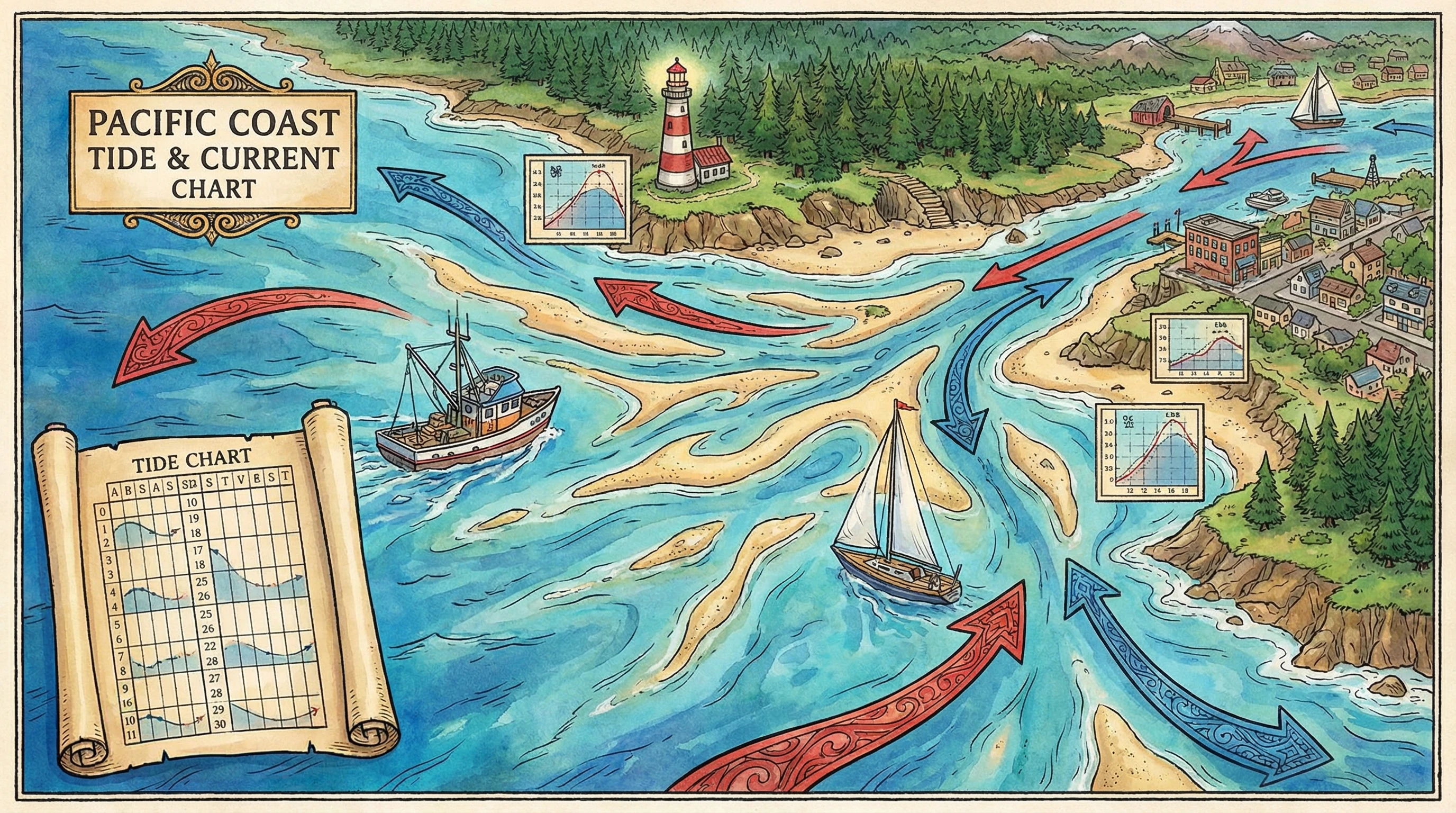
How Tide Predictions Work: Tools and Technology
Tide predictions use a combination of past measurements, mathematical models, and observations of the moon, sun, and earth position. The National Oceanic and Atmospheric Administration (NOAA) and other agencies gather data at hundreds of coastal stations, then use powerful computers to forecast future tides. This process works because tides are fairly predictable year after year. Predicting currents can be trickier since they change more with weather or river flow.
Modern technology helps a lot. I use tide and current predictions from trusted local sources and cross-check them with tide prediction apps on my phone. Many apps add weather, wind, and wave data, which helps paint a full picture for trip planning. In addition, developers continue to roll out features like hourly updates, customizable alerts, and visualization maps to make the information even more userfriendly.
- Tide Tables: Printed or digital listings showing times and heights of high and low tides for each day.
- Tide Charts: Graphical versions that show how tide height changes over hours or days.
- Tide Prediction Apps: Mobile apps that combine official data with interactive charts, mapping, and forecasts for every location I check.
If I’m going to a new spot, I like to double-check predictions with at least two sources. Slight differences sometimes pop up, but most apps and official charts generally match. Staying cautious with data can prevent surprises during your outing.
The Best Tide Prediction Apps and How to Use Them
Using the best tide prediction apps has made my trips on the water much easier to plan. Many of these apps are free or low cost, and they offer features like live data, mapping, and quick searching by location. Here are a few key ones people use:
- Tide Charts Near Me: Simple to use, covers thousands of locations, and offers offline data. Great when cell coverage is weak.
- Tides Planner: Lets me add favorite locations, set reminders, and see both tide and current info all at once.
- NOAA Tide Predictions: Official source for the United States, with trustworthy charts and tables including historical comparisons.
- FishTrack: Especially good for tide forecasting for fishing, with extra charts for temperature and surf height.
When I want to know the best time to fish, apps that show sunrise, sunset, moon phase, and tidal flows all in one spot are really convenient. For boating or sailing, apps that overlay current arrows on a map come in handy. Some apps even let you share reports or sightings with other users, making it easy to get real time insights about fast changing conditions.
Tide Forecasting for Fishing and Outdoor Fun
Tide forecasting for fishing makes a real difference in my catch rate. Many fish move more actively during tide changes, especially around high or low tide. Certain places only become accessible at the right tide. For example, some flats and sandbars only get covered during spring high tides, while outgoing tides may draw fish toward channels and deeper holes.
Beyond fishing, surfers use tide predictions to know when the waves break best. Kayakers and paddleboarders check current flow to avoid paddling against strong tide rivers or getting swept off course.
- High Tide: Good for fishing structure like rocks, reefs, or piers where fish hunt flooded prey.
- Low Tide: Reveals hidden bottom features, lets you explore tide pools, and can be good for clamming or crabbing.
- Slack Water: Times just before or after high or low tide when currents slow. Sometimes a really productive window for anglers.
Knowing these details has helped me plan trips for better fun and safety. If you’re planning a beach picnic, for example, knowing when the tide will cover or uncover sandbars can help you pick the best spot and prevent your towel from getting wet unexpectedly. Similarly, photographers love timing low tides on rocky beaches to capture unique sea life exposed for just a short time each day.
Current Prediction for Sailing and Boating
Strong currents or unusual tides are just as likely to trip up experienced sailors as novices. For anyone who sails, paddles, or rows regularly, current prediction for sailing is super important for route planning and trip safety.
Some popular areas, such as narrow channels, tidal rivers, or busy harbors, see currents that reach several knots. Planning passages to match the current can save time and fuel. If I miss the window, progress slows or stops completely. In windy conditions, opposing current and wind can create steep and choppy water, which can feel uncomfortable or even risky in small boats.
Sailors use specialized charts (often called current atlases) and apps to check both direction and strength of the water flow by the hour. These help decide when to leave the dock, pick anchorages, and stay clear of trouble spots. Comparing predicted currents with the day’s wind and weather completes the safety picture and can be a lifesaver, especially in areas known for unpredictable shifts.
Key Things to Consider with Tide and Current Predictions
Even with all the technology available, some basic tips always help me avoid surprises or problems. Here are the main things to keep in mind when planning an outing using tide and current predictions:
- Check Multiple Sources: Apps, official charts, and local knowledge work well together. If something looks strange or out of the ordinary, I double-check before setting out.
- Remember Weather Effects: Heavy rain, wind, or storms can temporarily change predicted water levels and current speeds. River mouths especially can see water piling up after heavy rains.
- Plan for Slack Water and Max Current: Know when currents change direction and when they reach their maximum speed. This is really important for crossing inlets or anchoring near tidal channels.
- Know Local Hazards: Rocks, sandbars, and shallow areas can become covered or exposed quickly. Charts and local advice help fill in the details that generic apps might miss.
Combining careful observation with digital data has always made my trips more enjoyable and less stressful. I always bring a backup chart as well, in case technology fails or the anchor needs to be reset on a tight or changing schedule.
Understanding Ocean Currents 2026: The Bigger Picture
The scientific side of understanding ocean currents is growing fast. In 2025, new satellites, ocean buoys, and highresolution models are producing better data than ever before. These advances improve not just day-to-day tide and current forecasts, but also help predict long-term changes in the ocean’s behavior, wildlife movements, and even climate.
For everyday outdoor activities, the basics remain the same. Keep up with current and tide predictions, and use them as part of the trip-planning toolkit. New tools may even offer real-time updates and push notifications to warn about sudden changes. As technology continues to step up, more people will be able to track down accurate local marine information even in remote places.
Practical Guide: How to Read Tide and Current Predictions
I remember feeling a bit lost when first reading tide tables and current charts. After a few times, it started to make sense. Here’s my simple approach to breaking it down:
- Pick Your Location: Make sure your data source matches the exact spot you plan to visit. Even a mile or two can make a real difference in timing and current speed.
- Identify High and Low Tides: Look for the times and heights of today’s high and low tides. Many places mark extrahigh or extremely low tides with symbols or color codes.
- Check Current Charts: Review both direction (usually shown with an arrow) and speed (in knots or miles per hour). Pay attention to “slack” times, when water movement is weakest.
- Cross-Reference Weather: Check for storminess, strong winds, or forecasted changes in air pressure. These can cause tides to be extra high or low for a day or two.
- Set Reminders: Some apps let me set alarms for my favorite fishing, sailing, or beach time, so I never miss the preferred window.
By following these steps, I feel confident even in unfamiliar places. If you’re new, don’t be afraid to ask others at the marina for additional tips or insights about local water movement.

Common Challenges and How to Handle Them
Tide and current predictions have limits. On occasion, I’ve seen differences between what’s predicted and what actually happens, often thanks to unusual weather. Other challenges include:
- Unusual Weather: Storm surges or strong winds can make the tide higher or lower than normal.
- Seasonal Changes: Spring floods or summer droughts change river flow, which can add to or take away from predicted currents near estuaries.
- Moving Sandbars: Storms or heavy rainfall reshape sandbars or inlets, changing local water flow patterns.
- Technical Glitches: Sometimes app updates go wrong, or buoys report faulty data. Backup paper charts or local experience can fill in the gaps. It’s always wise to prepare for unexpected malfunctions when heading into challenging waters.
Being flexible helps, as does talking to other boaters, anglers, or professionals in the area about recent changes they’ve noticed. The more information you gather, the better your trip outcome will be.
Expert Tips and Real-World Examples
My experience has taught me a lot of small tricks that add up to a smooth day out:
Ask Local Experts: Marina workers, fishing guides, and harbor masters often know about short-term changes or local trouble spots before anyone else. Their advice can be a game changer.
Use Satellite Views: Mapping tools with satellite images can show hidden channels, weed beds, and sandbars exposed at low tide. Comparing these with predicted water levels makes my route planning so much simpler.
Try New Tech Carefully: New gadgets and apps come out every year. I test them on a short trip before relying on them for longer adventures. Reliable gear and careful checking keep my experiences enjoyable and safe.
By combining these habits with reliable data, I’ve been able to avoid unexpected surprises and get the most from every trip. I encourage everyone to practice with predictions during short outings before trusting them far from shore.
Frequently Asked Questions
These are questions I often hear from friends and beginners:
How accurate are tide and current predictions?
Tide predictions are very reliable for most places and dates, since they use decades of data. Current predictions are usually good, but conditions like winds or heavy rain can switch things up a bit. Always check for updated reports, especially after storms.
What’s the difference between tide prediction and current prediction?
Tide prediction shows when the water will be highest and lowest. Current prediction shows when and where the water is moving fastest or slowest. For boating and kayaking, both are super important for safety.
Can I use phone apps for professional work?
Many professionals use apps daily, but for highest accuracy, I also check official government predictions and always bring paper charts as backup.
Final Thoughts
Learning to read tide and current predictions has made every water trip safer and more rewarding for me. Whether you’re into tide forecasting for fishing, planning beach days, or sailing unfamiliar waters, reliable predictions open up new possibilities. With a few good apps, trusted charts, and some experience, you can get the most from every outing. Anywhere the water calls, being prepared pays off.
Staying updated with the latest technology and understanding the science behind these cycles is more helpful than ever as tools keep improving into 2026 and beyond. Safe boating and good fishing depend on knowing what the water is doing now, and what it plans to do next.


2 Comments
This is one of the best articles I have read on Tides and Currents and the difference and how they can affect your day on the water. The information you gave the reader is spot on to teach the difference about current and tides. I will say I did learn the ocean has ocean currents like the Gulf Stream or Kuroshio Current can flow in one direction for months or years. Loved the blog post because it gave the resources to get the information and gave great advice. Now it is up to the individual. Keep up the great articles and websites.
Thank you so much for the kind words! I really appreciate you taking the time to share such thoughtful feedback. I’m glad the article helped clearly explain the difference between tides and currents and how each can impact a day on the water. It’s great to hear that learning about long-lasting ocean currents like the Gulf Stream and Kuroshio added value for you as well. My goal is always to provide practical, accurate information along with reliable resources so readers can make informed decisions for themselves. Thanks again for the encouragement and support—it truly means a lot!